A Guide To Tokyo’s Best Off The Beaten Trail Hiking Spots
Urban Escapes And Tips For Beginner Hikers

From mountain tops to deep river filled valleys, here are some of the capital’s most underrated countryside escapes.
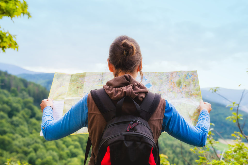
Summer in Tokyo can be a little temperamental, but when the weather is perfect, the sky is clear and the days long, there’s no time to waste. Although the city is full of endless attractions, one of the greatest things about being in Tokyo is its proximity to stunning natural hideaways. No matter your fitness level or trekking style there’s a hiking route for you a train-ride from the bustling streets of Shinjuku and Shibuya.
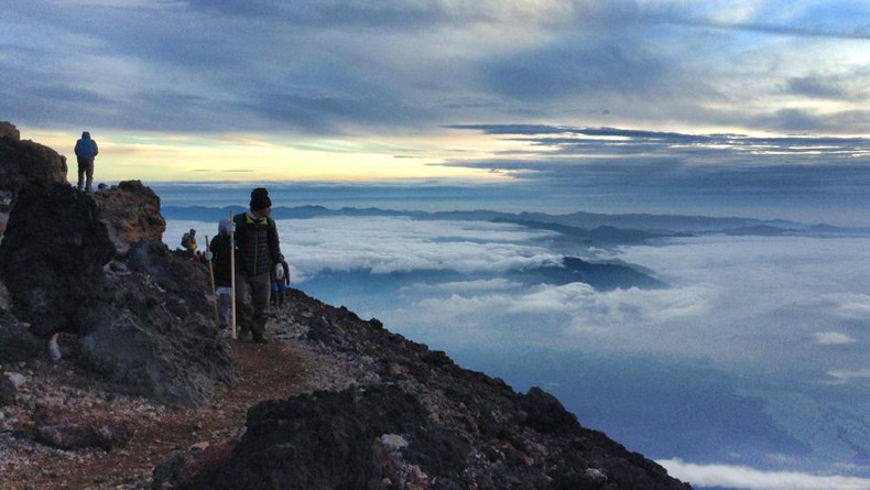
We all know about Mt. Fuji and Mt. Takao, both are beautiful treks, however, if you’re looking to beat the crowds and truly lose yourself in nature, here are four more ‘off the beaten track’ (pun intended) hiking hot spots.
Mount Tsukuba (筑波山)
If you head west from Tokyo you’ll stumble across the nation’s most famous hiking landmark, the legendary Mt. Fuji, but a short trek east, over to Ibaraki Prefecture, is where you’ll find Mt. Tsukuba, a slightly more low-key but not less beautiful mountain. Sitting a more manageable 877 meters high — compared to Fuji’s 3,776 meters — Tsukuba-san to the locals is the best place to go if you’re feeling fighting fit but maybe not quite Fuji-ready.
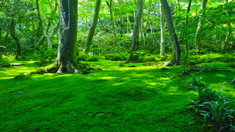
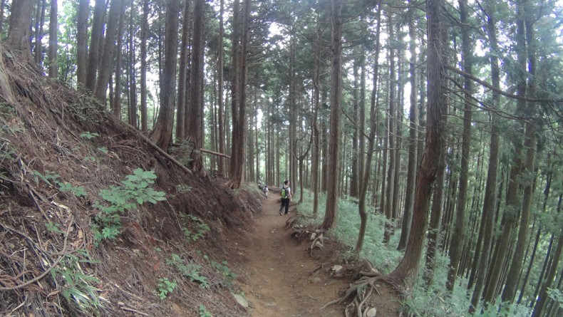
Don’t let its more humble stature fool you though, this double peaked mountain offers some pretty incredible views. On a clear day from the top, you’ll get a panoramic view of the Kanto plains including the densely packed skyline of Tokyo and Mt. Fuji. Because unlike many of the other mountains scattered along Japan’s volcanic landscape, Mt. Tsukuba is not a resting volcano; the soil here is far richer and full of lush, healthy green foliage perfect for cool shady strolling on a steamy summer’s day.
To scale the mountain there are a number of trails to choose suitable for all walking types. There’s also a ropeway for those who want to take the easy route. Great for beginners, this isn’t a difficult walk per se, but it will take a while so it’s recommended you put aside an entire day to make the most of it. See details of all Mt. Tsukuba hiking courses here.
Getting there: From Tokyo, catch the Tsukuba Express to Tsukuba station. From there you’ll find a local bus, which will take you to and from the mountain for about ¥700 each way.
Distance of hike: 1.5 km-10 km (depends on course)
Duration of hike: Approximately 1-4 hours (depends on course)
Mt. Kumotori (雲取山)
Crawling along the borders of Tokyo, Saitama, and Yamanashi prefectures is where you’ll find Mt. Kumotori, officially known as Tokyo’s highest point towering over the area at 2,017 meters. Given its size, this mountain is best explored over two days, but you don’t have to rough it, there are huts complete with hot meals and bathing facilities available. It is possible to do in a day if your fitness is at peak level and you start very early in the morning.
The most popular way to scale the mountain is to take the northern approach starting at Mitsumine Shrine in Saitama prefecture, stopping at the hut overnight before getting up early to watch the sun rise over near Fuji and continuing on and descending down the ridge to Okutama, or heading to Kamosawa for the bus back to town.
Given the logistics of getting, staying and climbing this mountain, it’s arguably best saved for those looking for a fresh Fuji alternative, and maybe not the best to take young kids or family if you’re all of the different fitness levels.
Getting there: From Tokyo, catch the Seibu line to Seibu-Chichibu station before hopping on a bus to Mitsumine Shrine (三峯神社). It’s from there you’ll start the journey.
Distance of hike: (Mitsumine Shrine round-trip) 21 km; (Mitsumine Shrine to Kamosawa) 24 km
Duration of hike: (Mitsumine Shrine round-trip) Approximately 8 hours, (Mitsumine Shrine to Kamosawa) Recommended for a two-day trip.
Hatonosu Keikoku Valley (鳩ノ巣渓谷)
For something a little closer to ground level, consider making the easy day trip to Hatonosu Keikoku Valley, a stunning, tree-filled pocket just under two hours from Shinjuku. Running along the Tama River, this valley is particularly popular in autumn when the passing season carpets the area in rich shades of red, gold and orange. An ideal spot for those more interested in taking a leisurely stroll than really testing their altitude limits, the scenic walk from Hatonosu Kobashi suspension bridge to the station will take about an hour in total.
Arguably one of the most scenic walks close to Tokyo, autumn is not the only time of year this valley is at its best. The crystal clear blue tinged water makes it perfect for getting out there and trying to capture the perfect nature shot all year round, while during the long steamy summer evenings it’s a hotbed of firefly activity.
Getting there: From Tokyo the best way to get to the valley is to take the Chuo Line heading to Ome from Shinjuku, then switching to the Ome Line at Ome Station and getting off at Okutama station. Walk from there. On your way back, walk to Kori station (or other stations along the route) and take the Ome Line.
Distance of hike: About 7 km (from Okutama St. to Kori St.)
Duration of hike: Approximately 2-3 hours (if you take it easy)
Mount Mitake (御岳山)
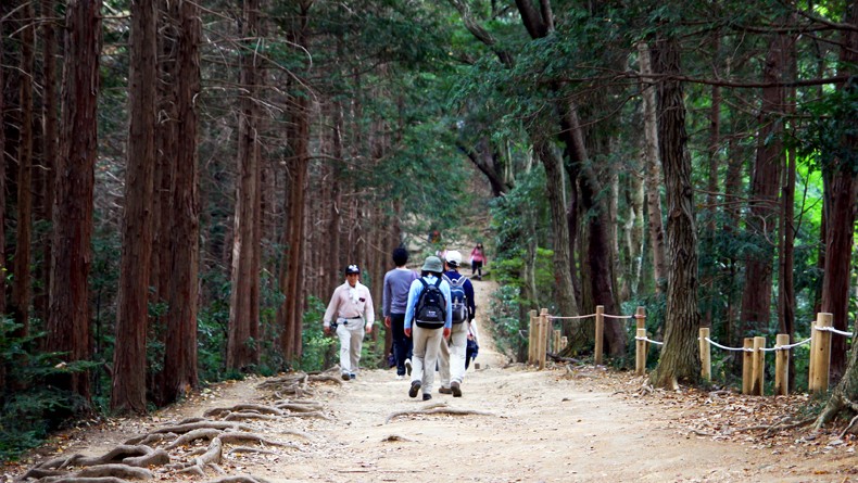
Head northeast from Tokyo and you’ll be well on your way to Chichibu-Tama-Kai National Park a stunning sprawling national park and home to the picturesque Mt. Mitake. Covered in a network of walking trails, dotted with waterfalls and featuring the rather lavish Musashi Mitake Shrine, it’s an easy place to spend the day with so much to see and do beyond the hiking trails.
A tranquil getaway from the hustle and bustle of inner-city Tokyo, it’s long been a go-to for city dwellers wanting to really experience a little rest and relaxation. The most relaxing way to explore the 929-meter high mountain is to first take a six-minute cable car ride from Takimoto Station, halfway up the mountain.
At the cable car stop sits a towering red torii gate, a symbol of the mountain’s divine spirituality. Here on the mountainside is Oshi-shuraku, also known as the Shrine Priests’ Village, filled with shops, it’s the ideal place to fuel up before making the pilgrimage to the summit to visit Musashi Mitake Shrine.
From the shrine it’s a bit of a ‘choose your own adventure’ situation, with a number of hiking trails continuing through the mountain’s picturesque surrounds. A popular route to take is Rock Garden, a narrow valley with flowing streams and a connection to the 1,267 meter Mt Otake for those adventure seekers hungry for mountaintop views.
Getting there: From Shinjuku, take the JR Ome Line to Mitake Station before making the journey to the Mitake cable car by bus. In total, the journey will take about two hours each way. Here is a quick map of Mt. Mitake’s key spots and hiking trails (in Japanese).
Distance of hike: Approximately 8 km (From Mitsumine-guchi station to Otaki Onsen. From there take a bus back to Mitsumine-guchi station)
Duration of hike: Approximately 4 hours
Read this personal account on hiking through Mt. Mitake for more information.
Tips for beginner hikers in Japan
Transport: If traveling via public transport, be sure to always check the last train and bus availabilities before heading off on your journey as transport out of the city center don’t typically run as often and finish early. If you plan out your journey on Google maps prior to departure you’ll often get an estimate of cost and timing.
Weather: Summer in Japan may be deceiving. Temperatures get pretty hot, but the humidity can make it feel a whole lot worse. Pack lightly and bring a small towel if you can to mop up the copious amounts of sweat you’ll be producing. Good shoes are important, but for hiking valleys, sneakers are fine.
Amenities: Like every other corner of the country there are typically many vending machines at en-route to making of the country’s hiking hot spots. However, the deeper you get the less likely you’ll spot one, so always pack enough food and water. There are also not many garbage bins around, so be prepared to carry your garbage.
Safety: Although Japan is famously very safe, it’s always paramount you stick to the marked hiking trails. There are a number of reasons certain areas are marked off, from unsuitable walking terrain to the more ominous threats of bears, hornets, boars, volcanic activity, poisonous gases and other potential dangers.
A number of hiking trails also actually have a box known as a tozan posuto box located somewhere within the vicinity. Here in the box you can leave your intended hiking itinerary and details, so if by some unlikely chance events go awry, authorities have a better idea of where you are.
Trail reviews: Yamareco is like Japan’s Trip Advisor for hikes with dedicated users regularly submitting useful information, posting pictures and offering guidance and tips on particular routes. If you’re a keen planner, this is an invaluable resource.


Related Articles You Might Like
Shinrin-Yoku: The Japanese Art Of Forest Bathing
If we've learned anything from watching Studio Ghibli films, it's that forests are enchanting, peaceful places full of magic and natural wonder... But did you...
Mt. Takao: The Closest Getaway From The Grind
After one too many naps on the train commute, sometimes it's nice to take a breather, get out of the city, and visit a place...
Journey to the Summit of Mt. Fuji
Mount Fuji: the mere mention of this iconic name resonates awe and admiration in the hearts of tourists, locals and hardcore mountaineers alike. Topping out...
Hiking Mt. Mitake’s Varied Scenery
Tired of spending your summers at overcrowded beaches or pools? Sometimes the best way to cool down in Japan during summer is to get out...
Leave a Reply