Hiking Solo Along the Kumano Kodo Iseji Route
A chance to cross the Unesco-listed pilgrimage route off my bucket list was an important lesson in facing my fears

"I knew that if I allowed fear to overtake me, my journey was doomed. Fear, to a great extent, is born of a story we tell ourselves, and so I chose to tell myself a different story from the one women are told. I decided I was safe. I was strong. I was brave. Nothing could vanquish me." — Cheryl Strayed
Doing a solo hike had been on my 30-before-30 bucket list ever since I’d pored over the pages of Cheryl Strayed’s Wild, the best-selling memoir about her 1,100-mile hike from the Mojave desert to the Oregon-Washington border. I’d clung to those lines, in particular, carrying them with me from university to graduation, traveling and then moving to Japan, twice. I’d always wanted to experience for myself the sense of empowerment that she describes; of finding redemption, of vanquishing my fears.
Except, over the years of building a routine of work, exercise, hobbies and socializing, I had also built a rack of convenient excuses for not starting the journey. There never seemed to be a right time or right place. Work was too busy. I had a relationship. I was too caught up in going through the motions. If I really thought about it, I was scared of what would happen if I went hiking alone as a woman, in rural Japan.
And now, about to turn 30 years old, I felt more afraid than ever.
Still, I kept thinking about it. I researched long-distance hikes in Japan, signed up to newsletters, watched TED talks. I’d even start planning but then would give up halfway through and instead spend time indulging my feeling of panic over how old I was getting.
But then, in an odd instance of universal intervention, I was asked to take on a project for work, covering one of the most well-known pilgrimage routes in Japan: the Kumano Kodo. In order to do it, I’d have to experience the hike for myself. They wanted me there in early December — one week before my 30th birthday.
Uncharted territory
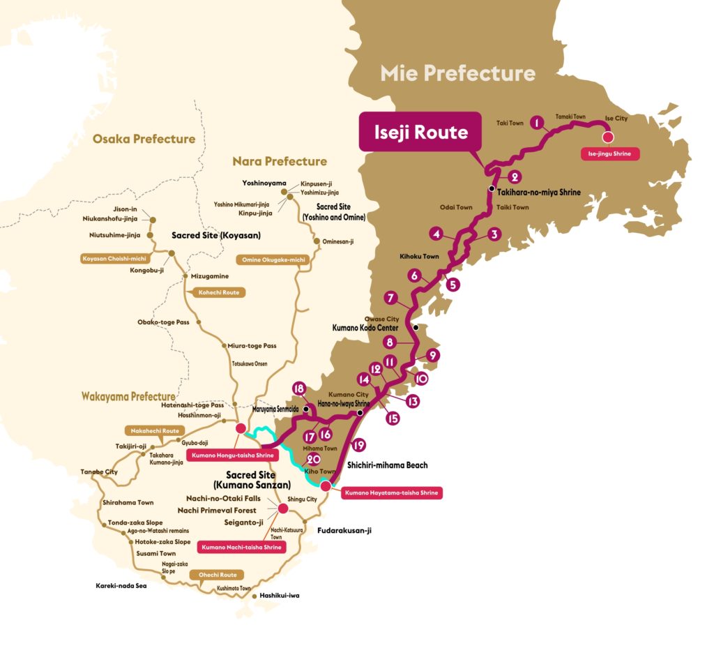
The Kumano Kodo is a network of sacred pilgrimage routes in southern Kansai that links the religious centers of Mt. Koya, the Ise Jingu and the Three Grand Shrines of Kumano: Hongu Taisha, Hayatama Taisha, and Nachi Taisha. Its designation as a World Heritage Site makes it one of only two Unesco-listed pilgrimages in the world — the other being the Camino de Santiago, or Way of St James, in Spain.
In the late Heian Era (794-1185), pilgrims began to engrave pathways linking these sites through the mountains as they traveled in search of divine providence — one of the paths to purification formed into the Iseji Route. This 170-kilometer pilgrimage traced the edge of the Kii Peninsula, beginning at the Ise Jingu and threading through mountains and coastal paths in the Higashi Kishu region in southern Mie Prefecture, ending up at the Hayatama Taisha in Wakayama Prefecture.
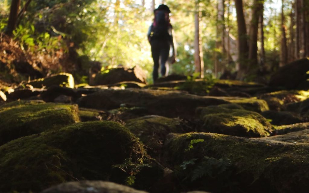
A Go-Pro view of the Magose-Toge Pass.
As industrialization took hold of Japan, the number of pilgrims declined and the Iseji Route was left to nature’s devices. It’s only recently that the Kumano Kodo has seen a resurgence in visitors thanks to its World Heritage designation in 2004, though most of these modern pilgrims gather along the more well-known and better-developed paths on the Wakayama side. The Iseji Route is generally overlooked and remains largely uncharted territory by tourists.
As part of the project to help promote the area, the Iseji Route was my pilgrim’s path to follow. Remote, isolated and neglected for hundreds of years, this was exactly the kind of hike I had been looking for.
It was, as fate would have it, totally wild.
Into the holy wild
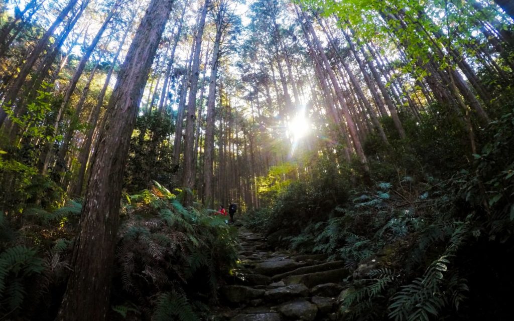
The Matsumoto-Toge Pass in Kumano City.
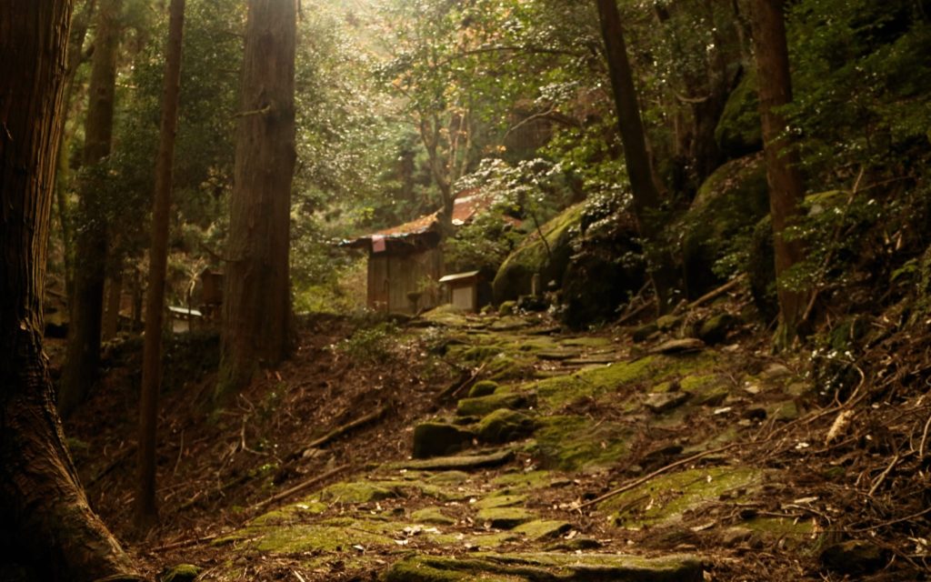
The Iseji Route itself is actually made up of around 20 “passes” or hikes that cover urban, mountainous and coastal terrain. The original route from the Ise Jingu to the Hayatama Taisha typically takes around two weeks. I had only four days so I was given an express itinerary that would cover the highlights. I would skip Ise City and head straight to Kihoku Town, the first of five towns and cities I’d be crossing through during the trip. Each day I would be doing one or two hikes and staying in the towns overnight.
You’ll be able to dip into the hospitality of each town as you travel.
The first day and my first hike
My starting point was actually Owase station, easily accessible with an early morning Limited Express Wideview Nanki train from Nagoya where I’d stayed the night before.
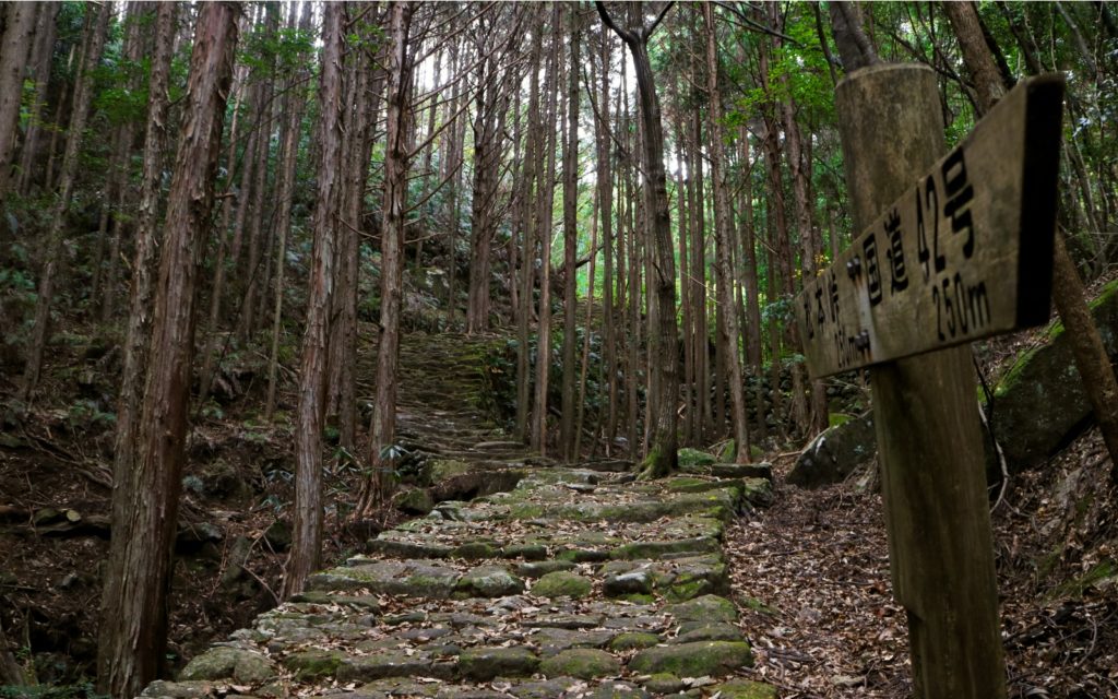
From Owase station I took a taxi to Washige to the trailhead for the Magose-toge Pass, the 7th pass along the Iseji Route. Guidebooks describe this path as the most atmospheric thanks to the excellent preservation of the stone pathway, laid up until the end of the Edo period to make the paths easier to walk.
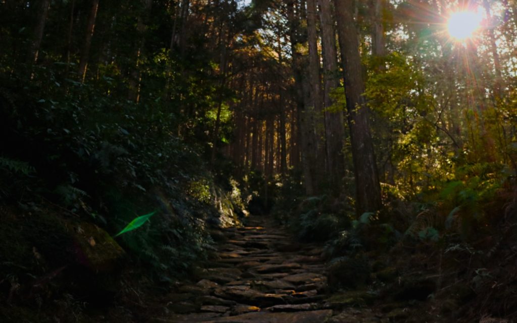
Sunlight filtering through the trees along the Magose-Toge Pass.
It was a breathtaking introduction to the Kumano Kodo; an exact match for the photo on the front of my guide map. Weaving through the towering hinoki trees, sunbeams crisscrossing on the black stone, it was isolating and rejuvenating at the same time.
At the summit, there was a small clearing with a brick shrine that marked a training ground for local yamabushi or mountain ascetics. A rusty ladder to the right led up to the top of a giant boulder from where I could see a panoramic view of forests, mountains, and ocean. Standing on the top of my first Iseji Route summit, it was too high and precarious to feel safe, but I did feel strong, and just a little bit brave.
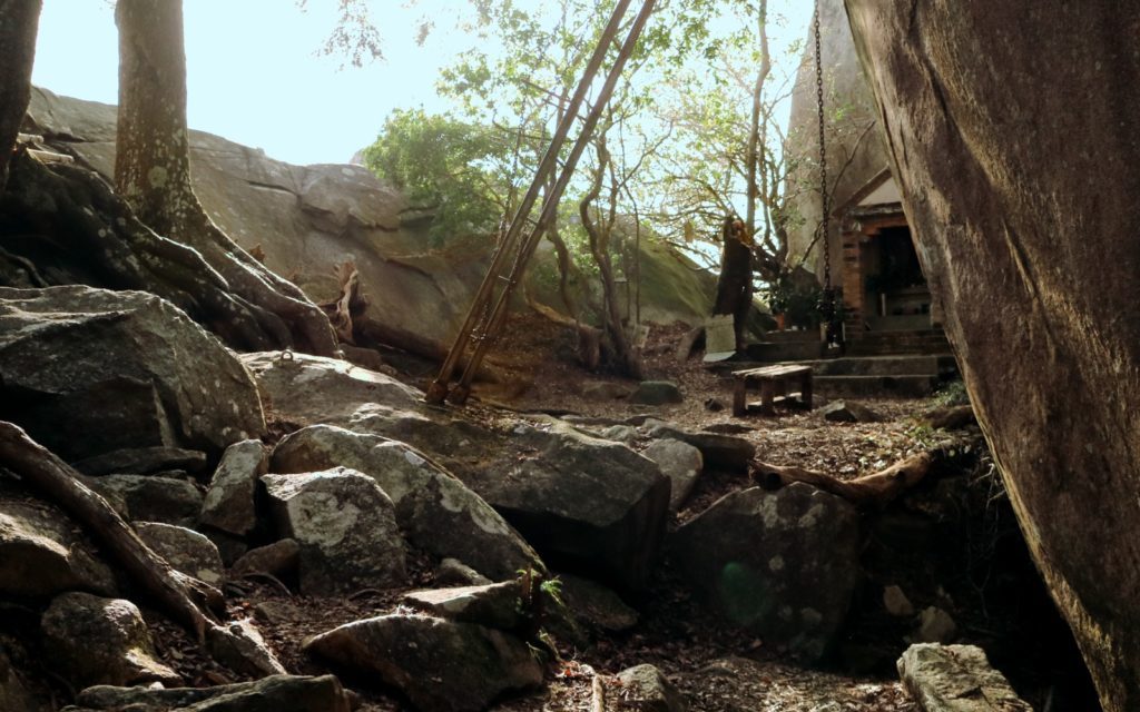
A spiritual and physical training ground at the top of Mt. Tengura.
A tough climb
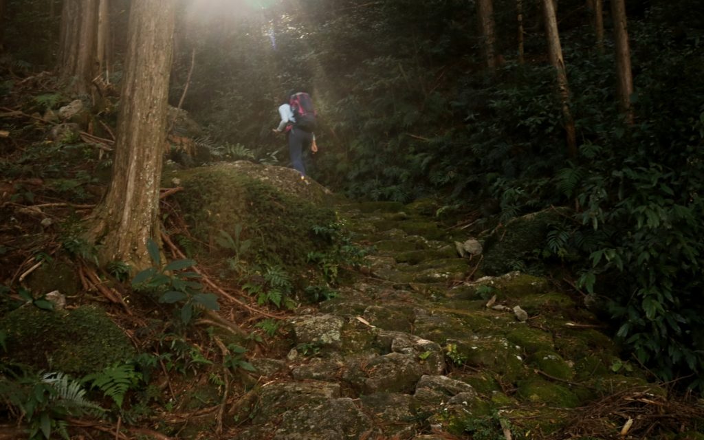
The second day I woke up early to pay a visit to the Kumano Kodo Center, a beautiful building made entirely of fragrant beams of hinoki connected by interlocking joints. The kind guide there helped me map out that day’s hike across Mt. Yakiyama, said to be the most challenging of all the passes on the Iseji Route.
Mt. Yakiyama.
He warned me that I would most likely be entirely alone, that both the ascent and descents were tough, and that it was easy to slip on the stones — moss-covered from the lack of feet crossing through, especially in winter.
Walking from the center to the trailhead, I remember I was scared. Not about the physical challenge but the fact that I would be up there amongst the sea of black trees all by myself.
The ascent was steep and rugged.
Mt. Yakiyama was dark, misty and eerily quiet but I tried to concentrate on just pushing forward. And breathless and sweating, the more I continued on the less afraid I started to feel. When I came out the other side seven hours later, ending the hike at a tranquil stretch of beach, it was like I had conquered a fear — just a small one, but I had done it.
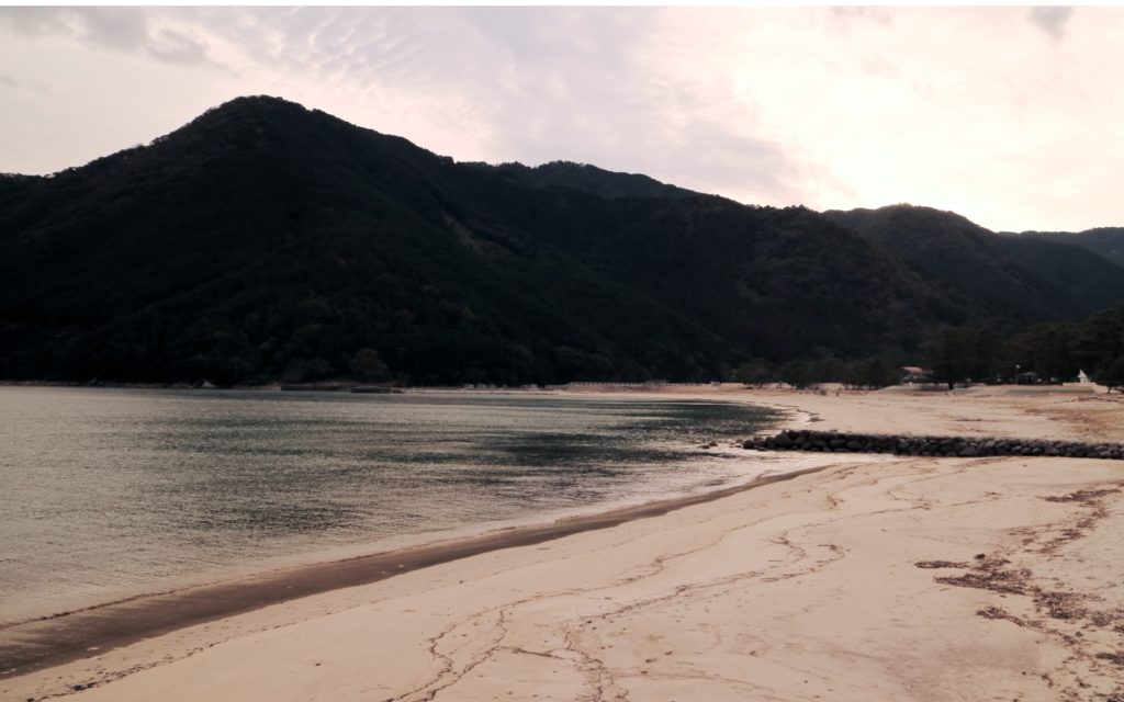
The sun setting on Mikisato beach.
Claiming my castle
By the third day, my legs had started to ache. Luckily the morning’s hike was just a short, but no less scenic path through the mountain via the Hadasu Pass. After, I made my way into Kumano City. There’s a dinky local train that chugs along the coastline, and you can use this to get to the different trailheads along the Iseji Route to save time and energy.
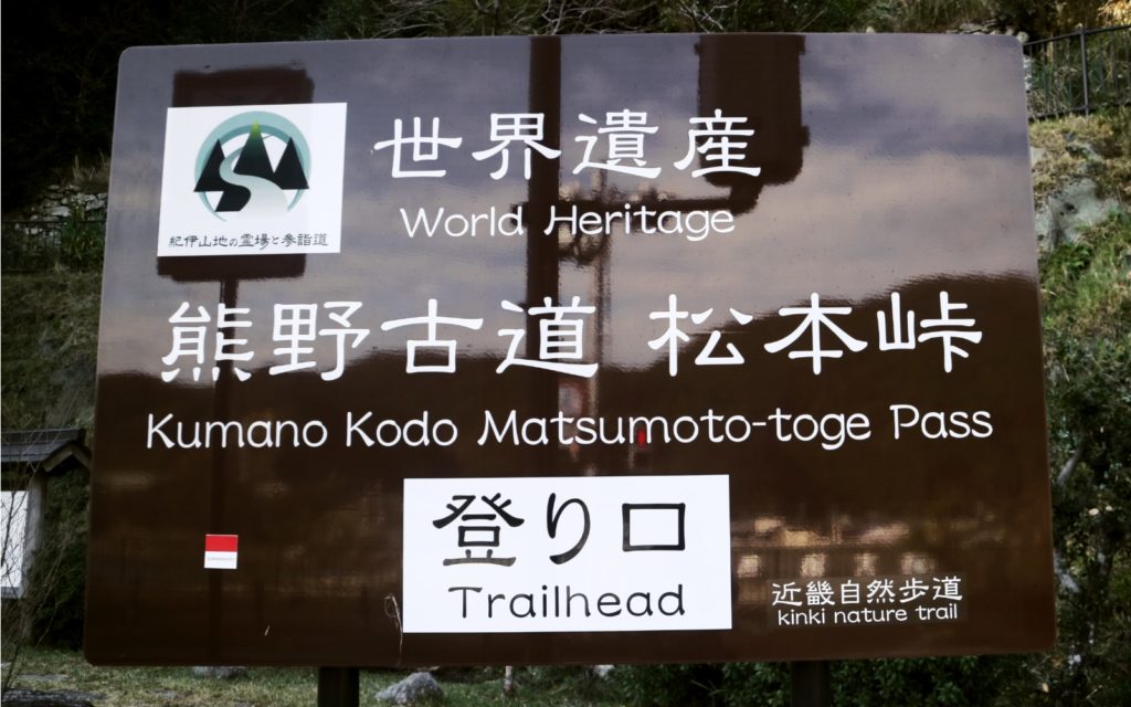
The trailhead for the Matsumoto Toge Pass.
In Kumano, I joined the Matsumoto-toge Pass, one of the most popular along the Iseji Route thanks to its accessibility, and for being extremely photogenic.
It had been only days but I was already taking on the persona of a seasoned hiker; boots crusty from mud, a windbreaker permanently wrapped around my waist, my bag carefully packed in a way that took the weight off my shoulders, and a better sense of direction than I’d ever achieved in Tokyo.
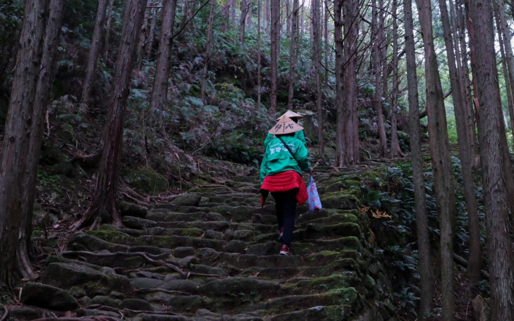
A couple of local guides climbing the Matsumoto-Toge Pass.
An hour’s climb later, I had lunch at the top of the mountain with an incredible view of Shichirimihama beach — a Unesco-listed, 22-kilometer stretch of silver sand that signaled the border between Mie and Wakayama prefectures.
Back down at sea level, I decided to visit some of the other World Heritage sites in the area. The Tourist Information Center in front of Kumano City station has bikes that you can rent to cycle around town. I started at Hanano-Iwaya, Japan’s oldest shrine, and took pictures at the Shishi Iwa, or “Lion Rock,” which to me looked more like a bird calling out to sea.
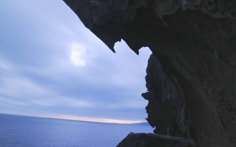
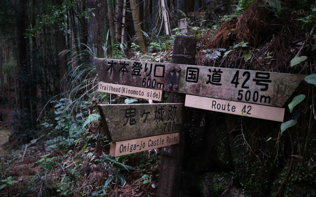
Oniga-jo.
My last stop was Oniga-jo, Demon’s Castle in English, an extraordinary cave and arch formation carved into the cliffside. There, I sat inside the giant alcove to watch the sunset, dirty, tired, my hair matted with sea salt, and claimed it as my castle.
Monuments of men
For my last day, I took a tour to the Tori-toge Pass and the Maruyama Senmaida, a striking stack of tiered rice paddies set on a steep slope. My guide, took me through the history of the Kumano Kodo as we climbed, pointing out the different viewpoints and how they would have looked to the path’s original pilgrims way back when.
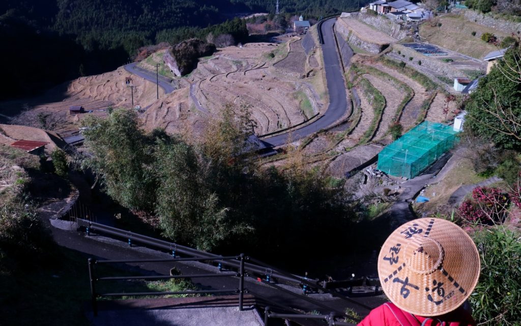
Looking down at the Maruyama Senmaida rice paddies.
At the top of the Tori-toge Pass, we had an extraordinary bird’s-eye view of the rice terraces sloping down into the valley before climbing back down to stand among them. She explained that in spring and summer the rice paddies get packed with tourists trying to get that postcard photo. Now, in the middle of winter, the fields were stark and bare.
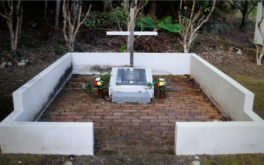
She told me that another guide, who I’d met on my first day, would be coming to pick us up. Her friend, Kawamura-san, wanted to show me something nearby. About a 5-minute drive away from the Maruyama Senmaida, there was a Prisoner of War grave next to a slice of abandoned farmland. Kawamura-san told me that during the Second World War there had been an internment camp for British soldiers in the village. Locals had laid a small gravestone as a monument, a moving tribute to the force of love even in war.
As we drove back to Kumanoshi station for my train back to Tokyo, I kept thinking about that grave and what it meant for something to be a monument. The whole Higashi-Kishu area was filled with them; places like Hanano-Iwaya and Oniga-jo were commemorations to the power of nature. Really, the Kumano Kodo itself was one incredible memorial, dedicated to the memories of the millions of pilgrims who had journeyed along it. Those who had almost turned back, got lost and nearly given up but always kept moving forward; those who hadn’t allowed fear to overtake them.
Completing the Iseji Route hike proved that I was strong. I was brave. Even though I had been scared, I didn’t have to be. Three days later, on my birthday, I triumphantly crossed “solo hike” from my bucket list. On my new 40-by-40 list, I added “long-distance thru-hike” in a place I’d never been to before. This time I know for sure that I’ll do it.
Planning a hike along the Iseji Route
There are 20 separate “passes” or hikes along the Iseji Route.
There’s a very user-friendly Kumano Kodo Iseji Navigator that links Google maps to a short description of each of the routes, making it easy to plan your route. For guides, you can make inquiries at this website. If you’re looking for a comprehensive overview of the route, the official Kumano Kodo Iseji Route Mie prefectural website is fantastic.
The best time to hike the Iseji Route is between December and April, avoiding the rainy season and the summer humidity, which brings mosquitoes in their hordes to the mountains. In early December, when I was there, the weather was chilly but not freezing. Most of the time I was wearing only a couple of layers and a windbreaker — less when I was hiking.
The Iseji Route is not a thru-hike and you can’t camp on the mountainside; you’ll need to plan accommodation for each of the nights you’re there. There’s a decent range of options in each of the towns but here are the places I stayed at:
How to get there
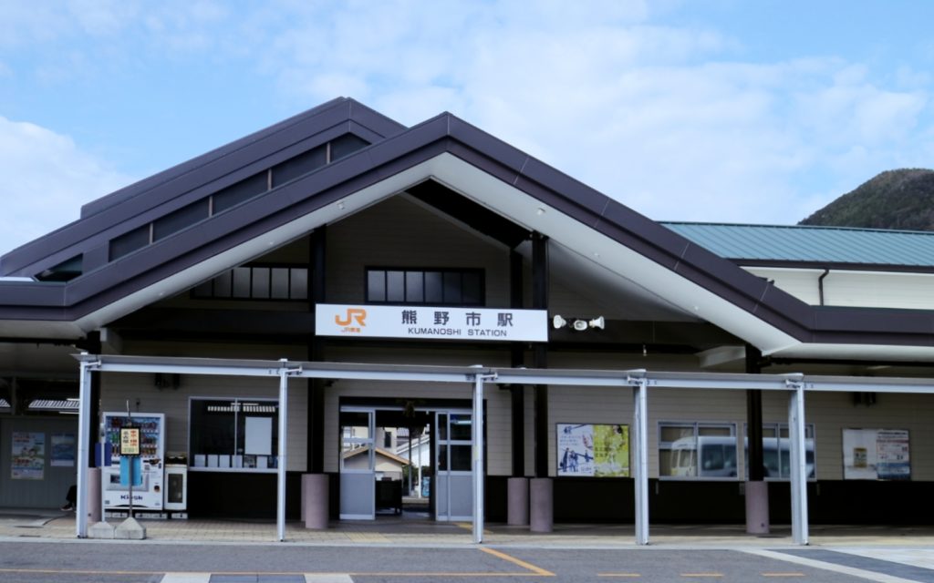
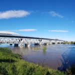
Kumanoshi Station in Kumano City.
Access to the Kumano Kodo Iseji Route will depend on your start point. If you are doing the full hike, Iseshi Station is the closest to the Ise Jingu. You can take the Kintetsu Railway line from Nagoya, Kyoto and Osaka stations.
In Higashi Kishu, the main access points are Kii Nagashima station, Owase station, and Kumanoshi station. All three are served by the highspeed JR Limited Express Wideview Nanki train via Nagoya (if you’re coming from Tokyo, approx. 2.5 hours, ¥6,090) or Matsusaka station (if you are coming from Kyoto or Osaka, approx. 2 hours, ¥3,120).
There is also a local train line called the Kisei-Hon Line that connects each of the towns of the Higashi-Kishu region. Buses do run from the towns to certain attractions, like the Kumano Kodo Center. Check at the relevant Tourism Information Center for up-to-date info.
Safety tips for female solo hiking in Japan
Signs along some of the passes are in English. However, you should always make a note of the names of the hikes you’re doing in Japanese, especially for the more remote passes.
The terrain along the Kumano Kodo Iseji Route has a moderate elevation, and each of the passes, especially the stone parts, is generally easy to cross in standard hiking boots or even sturdy sneakers at a push. You don’t need to haul special trekking gear or bring more than one day’s worth of water and food with you.
As a basic list, you should bring:
- Multiday hiking backpack with a rain cover
- Lightweight hiking boots or trail runners. The stone paths can get slippery in the rain so bring shoes with the proper grip and movement.
- Rain jacket/windbreaker. Be prepared for rain.
- A flashlight or headlight
- A bear bell that you can attach to your backpack
- Emergency flare or another signaling device
- Water and food: You’ll be able to replenish your supplies back in town.
Along each of the passes there are short wooden pillars every hundred meters or so that are marked with emergency numbers. Make sure to carry a working cell phone and a portable charger with you at all times. Some of the passes are quite isolated, especially in the winter, so it is also a good idea to bring an emergency flare or another signaling device just in case.
Bears are very rarely sighted in the area. However, most hikers will attach a small bear bell to their bag to scare the animals away in the unlikely event of a bear encounter.
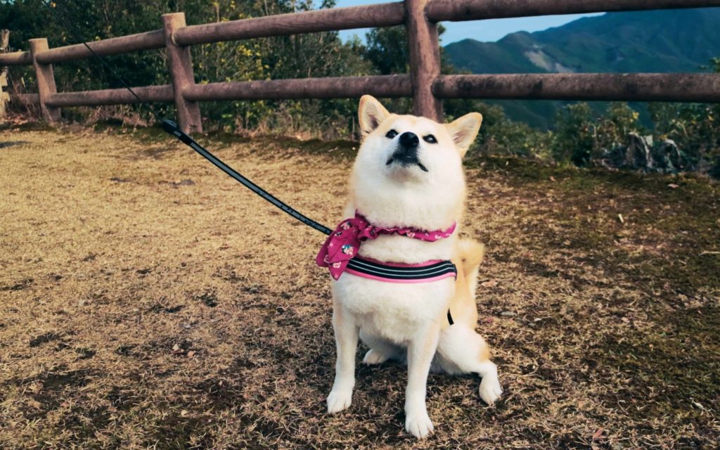
Luckily I didn’t encounter a bear, but I did meet local guide’s Shiba dog “Rin-chan” along the journey.
Most importantly, be sure to inform several people of where you are going and when, and have the details of an emergency contact stored somewhere with you.
All that said, you will probably meet other hikers along the way. Japanese hikers are very friendly and ready to help. Say “Konnichiwa” when you pass by to greet them and keep a little phrase book with you just in case — at least so that you can proudly explain your solo adventure.


Related Articles You Might Like

100 Yen Shop Must-Haves for the Kitchen
From kitchen organizers to making your dinner prep easier, head to Japan’s 100 yen shops for your next kitchen upgrade.
4 Japanese Laws That Desperately Need To Be Amended For Women
While many laws have been created and updated to improve the lives of women in Japan, others have not.

5 Ways To Survive The Rainy Season in Japan
The dreaded rainy season is here, but we have the answers to survive it!

Japanese Point Cards Explained: A Savvy Guide
This guide will help you decide which Japanese point cards are right for you, from the basics to in-depth insight into the most popular cards.
Leave a Reply